


Alberta, Wilcox County, Alabama
About
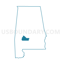
Outline

Summary
| Unique Area Identifier | 523116 |
| Name | Alberta |
| County | Wilcox County |
| State | Alabama |
| Area (square miles) | 15.75 |
| Land Area (square miles) | 15.74 |
| Water Area (square miles) | 0.01 |
| % of Land Area | 99.94 |
| % of Water Area | 0.06 |
| Latitude of the Internal Point | 32.23333630 |
| Longtitude of the Internal Point | -87.43530000 |
Maps


Graphs
Select a template below for downloading or customizing gragh for Alberta, Wilcox County, Alabama


Neighbors
Neighoring Voting District (by Name) Neighboring Voting District on the Map
- Boykin, Wilcox County, AL
- Prairie Bluff, Wilcox County, AL
- Safford Community Center, Dallas County, AL
- Taylorville Voting Booth, Marengo County, AL
Top 10 Neighboring County Subdivision (by Population) Neighboring County Subdivision on the Map
- Thomaston CCD, Marengo County, AL (1,368)
- Alberta CCD, Wilcox County, AL (1,308)
- Safford CCD, Dallas County, AL (557)
Top 10 Neighboring Unified School District (by Population) Neighboring Unified School District on the Map
- Dallas County School District, AL (23,064)
- Wilcox County School District, AL (11,670)
- Marengo County School District, AL (8,822)
Top 10 Neighboring State Legislative District Lower Chamber (by Population) Neighboring State Legislative District Lower Chamber on the Map
- State House District 72, AL (39,414)
- State House District 67, AL (37,878)
- State House District 69, AL (37,572)
Top 10 Neighboring State Legislative District Upper Chamber (by Population) Neighboring State Legislative District Upper Chamber on the Map
Top 10 Neighboring 111th Congressional District (by Population) Neighboring 111th Congressional District on the Map
Top 10 Neighboring Census Tract (by Population) Neighboring Census Tract on the Map
- Census Tract 9731, Marengo County, AL (2,150)
- Census Tract 347, Wilcox County, AL (1,308)
- Census Tract 9570, Dallas County, AL (1,274)